
Maps and lay-out of Fredrikstad fortress
Where it is? The fortress is located in southern Norway at the mouth of the Glomma River, not far from its confluence with the Skaggerak Strait.

You need to travel from Oslo by train in a southeasterly direction to the Swedish border in 50-55 minutes for only 260 kroons. You can also take the bus for about the same money, but it will be an hour longer trip.
Lay out of Fredrikstad fortress

- New town of Fredrikstad
- Glomma river with free ferry crossing
- Old town (Gamlastan)
- Bastion front
- Wet ditch
- Drawbridge
- Batardo
- Glacis
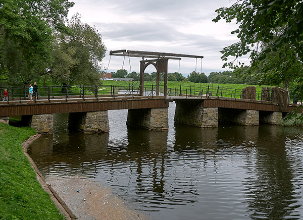
Drawbridge
Land forts and fortress:
Bip Castle Gatchina Ivangorod Izborsk Kexholm Kirillov Monastery Koporye Novgorod Pechorskiy Monastery Peter&Paul Fortress Porkhov Pskov Schlisselburg Staraya Ladoga Tikhvin Vyborg Hameenlinna Hamina Kastelholm Kymenlinna Lappaenranta Raseborg Castle Savonlinna Tavetti Turku Visby Fredrikstadt Fredriksten Hegra Fort Hoytorp Fort Arensburg Narva Tallinn Antipatris Caesarea Jerusalem Latrun Fort Masada
Sea forts and fortresses:
Alexander Fort Ino Fort Krasnaya Gorka Fort Kronstadt: city and Kotlin isl. Kronstadt: North Forts Kronstadt: South Forts Trongsund Hanko Svartholm Sveaborg Marstrand Siaro Fort Vaxholm Oscarsborg
Artillery batteries and individual guns:
Hemso Fort
Fortified areas and defensive lines:
Karelian Fortified Area (KaUR) KrUR Leningrad Mannerheim Line Nevsky Bridgehead VT Line Harparskog Line Mikkeli Salpa Line Gothland
Russian
S e a r c h All news
©2026 Goss.Ru