The top of the plateau of Masada
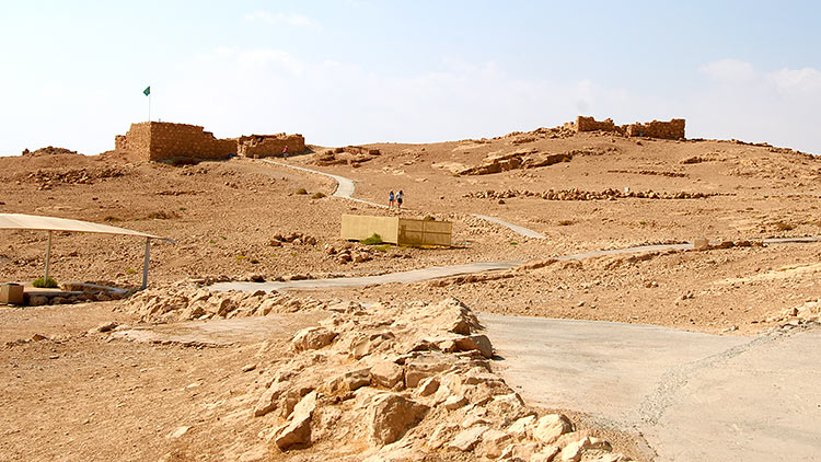
The plateau is more or less flat, has a diamond shape, stretching from south to north with size of 550 by 270 meters. The fortress occupies the whole of this area. Josephus writes that the days of Herod the soil inside the fortress was 'fat' and could be reserved for the vegetable gardens and orchards, to supply products of the garrison during the siege. The picture shows the view from the plateau of the Snake Gates trails. Ruins of the so-called Small (guest) palaces are seen.
Next photo ->Land forts and fortress:
Bip Castle Gatchina Ivangorod Izborsk Kexholm Kirillov Monastery Koporye Novgorod Pechorskiy Monastery Peter&Paul Fortress Porkhov Pskov Schlisselburg Staraya Ladoga Tikhvin Vyborg Hameenlinna Hamina Kastelholm Kymenlinna Lappaenranta Raseborg Castle Savonlinna Tavetti Turku Visby Fredrikstadt Fredriksten Hegra Fort Hoytorp Fort Arensburg Narva Tallinn Antipatris Caesarea Jerusalem Latrun Fort Masada
Sea forts and fortresses:
Alexander Fort Ino Fort Krasnaya Gorka Fort Kronstadt: city and Kotlin isl. Kronstadt: North Forts Kronstadt: South Forts Trongsund Hanko Svartholm Sveaborg Marstrand Siaro Fort Vaxholm Oscarsborg
Artillery batteries and individual guns:
Hemso Fort
Fortified areas and defensive lines:
Karelian Fortified Area (KaUR) KrUR Leningrad Mannerheim Line Nevsky Bridgehead VT Line Harparskog Line Mikkeli Salpa Line Gothland
Russian
S e a r c h All news
©2026 Goss.Ru